The River Suir at Ardfinnan: Ford, Bridge, Weir and Blueway
Every landmark in Ardfinnan, from the castle to the mill, was placed where it is because of the river.
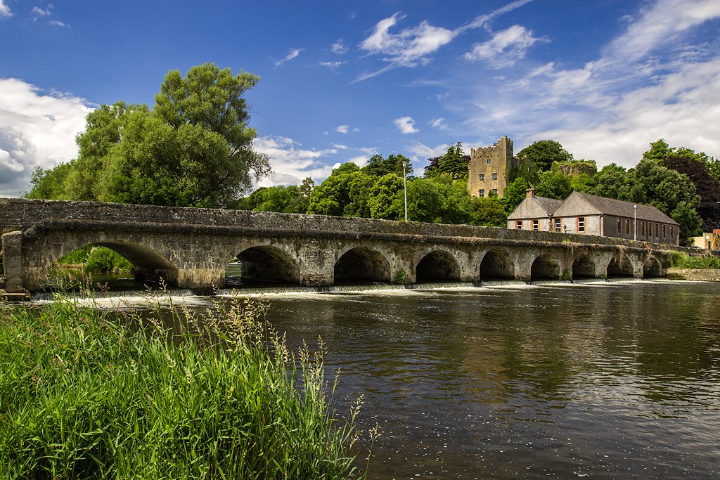
The River Suir is the reason Ardfinnan exists where it does. At this bend the river is wide enough to need a bridge and shallow enough once to have been forded, and the village grew around the crossing: first a monastery, then a castle, then a mill and its weir. Today the same water carries anglers, paddlers and, from the bridge, the best view in the village.
The river in brief
According to Wikipedia, the Suir is 185 km long. It rises on the Devil’s Bit Mountain, just north of Templemore in County Tipperary, runs south past Thurles, then turns east along the foot of the Comeragh Mountains. It passes Cahir, Clonmel and Carrick-on-Suir before meeting the River Barrow near Cheekpoint and reaching the sea between Dunmore East and Hook Head. Its catchment is about 3,610 square kilometres, and the Aherlow is among its tributaries.
Ardfinnan lies on the stretch between Cahir and Clonmel, around 10 km downstream of Cahir.
The ford
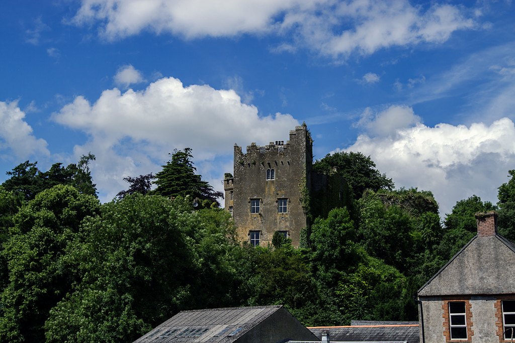
The castle stands, in Wikipedia’s words, “on a large rocky incline above a ford in the river”. The village article describes that ford as an important waypoint for pilgrims, and the monastic settlement beside it is covered in our piece on Saint Finnan and early Christian Ardfinnan. A shallow crossing on a pilgrim road was worth guarding, and that is the logic behind Ardfinnan Castle, raised in 1185.
The bridge
The National Inventory of Architectural Heritage (NIAH) says a crossing has existed here since at least 1311. The bridge you see now is a thirteen-arch road bridge rebuilt around 1800, which the NIAH says probably keeps medieval or seventeenth-century fabric. Older writers counted fourteen arches and called it as old as the castle; treat that as tradition. The full account, including the cutwaters and the repair works, is in Ardfinnan Bridge: One of Ireland’s Oldest River Crossings.
One detail of the stonework is really about the river. The NIAH notes three dry round arches at the south end that carry water only in flood, and a segmental arch over the millstream at the north end. The bridge was built to cope with a river that rises.
The mill and the weir
A weir raises the water level so that part of the flow can be turned into a mill race. The 1654 survey, as quoted in Wikipedia’s castle article, lists the manor of Ardfinnan as “castle, mill and weir”, amounting to five acres leased to a Richard Butler. So the weir is documented in the seventeenth century at least. We found no source that dates its construction.
The mill race and the bridge are tied together physically too. The NIAH’s record for the mill says it sits so close to the bridge that “the mill race flows under its parapet wall”. The river later drove the woollen factory; that story is told in The Ardfinnan Woollen Mills. Wikipedia’s article on the Suir itself notes that the river’s flow once powered watermills such as Ardfinnan Woollen Mills.
Fishing: salmon and trout
Wikipedia describes the Suir as popular with anglers, with abundant brown trout and salmon. It also records an Irish river salmon record of 57 lb, taken on a fly in 1874, and says salmon stocks have declined in recent years.
For present-day rules, go to the regulator rather than a blog. A summary of Inland Fisheries Ireland guidance published by Visit Cahir gives a salmon and sea-trout season of 17 March to 30 September, says the Suir is catch and release for salmon in 2026, and names Cahir and District Anglers Association as a permit contact. It stresses that a salmon licence and a club permit are different things, and that public access to the bank does not give permission to fish. We did not find a source naming specific beats at Ardfinnan, so we will not name any.
Flooding
The river that fed the mill can also overflow. The three dry arches in the bridge exist for that reason. We have not found a published account of particular flood events at Ardfinnan, so we make no claims about dates or depths. For current flood information, use the Office of Public Works flood maps and Tipperary County Council notices.
The Suir Blueway
The Suir Blueway Tipperary is a walking, cycling and watersports route of about 53 km from Cahir to Carrick-on-Suir via Clonmel, which Sticky Bottle reports cost just under €6 million. Its continuous cycling section is the 21 km towpath from Carrick-on-Suir to Clonmel, so it does not run through Ardfinnan. The Cahir to Clonmel reach, which includes this stretch of river, is mainly for paddlers, and the same report lists an access point as “Ardfinnan/Sandybanks at Marlfield”, though its wording does not make clear exactly where that point lies. Check the current access arrangements before setting out; the river rises quickly after rain.
Seeing it for yourself
Stand on the bridge and look upstream: the castle on its rock, the mill at its foot, the river spreading across its wide bed. That single view contains a ford, a bridge, a mill, a weir and a fishery. Start with the history of Ardfinnan for the wider story, or go on to things to do near Ardfinnan.
Frequently asked questions
How long is the River Suir?
About 185 km (115 miles), according to Wikipedia. It rises on the Devil's Bit Mountain near Templemore in County Tipperary and reaches the sea through Waterford Harbour.
Is there fishing on the Suir near Ardfinnan?
The Suir holds brown trout and salmon. A summary of Inland Fisheries Ireland guidance gives a salmon and sea-trout season of 17 March to 30 September and says the Suir is catch-and-release for salmon in 2026. Rules, licences and permits change, so check with Inland Fisheries Ireland and the local angling club first.
What is the Suir Blueway?
A walking, cycling and paddling route of about 53 km from Cahir to Carrick-on-Suir via Clonmel. The cycling section is the 21 km towpath from Carrick-on-Suir to Clonmel; the river between Cahir and Clonmel, which passes Ardfinnan, is mainly for paddlers.
Is Ardfinnan Bridge very old?
The National Inventory of Architectural Heritage says a crossing has existed at the site since at least 1311. The present thirteen-arch bridge was rebuilt around 1800.